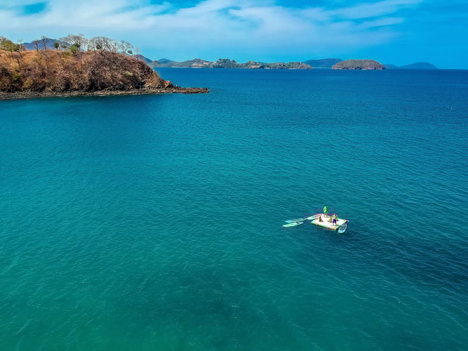
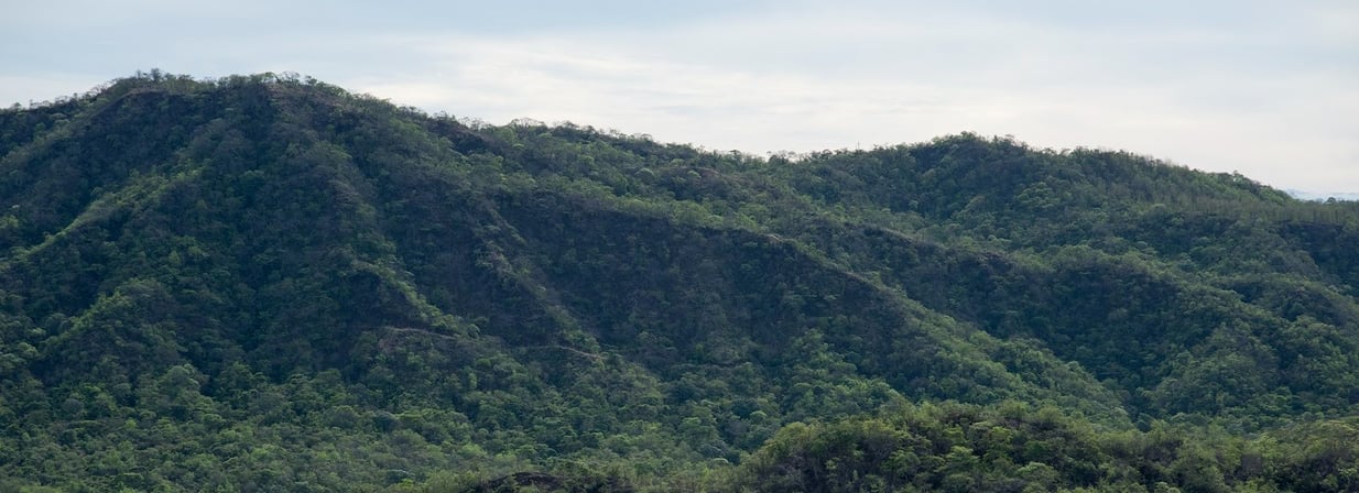
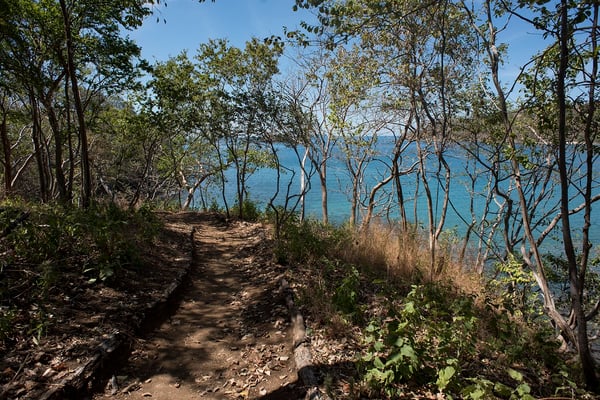
The town of Las Catalinas is located in Guanacaste, Costa Rica, surrounded on one side by a tropical dry forest reserve and on the other by Playa...
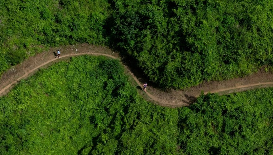
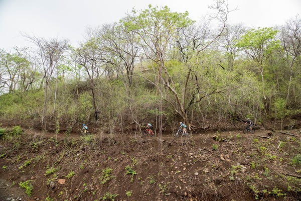
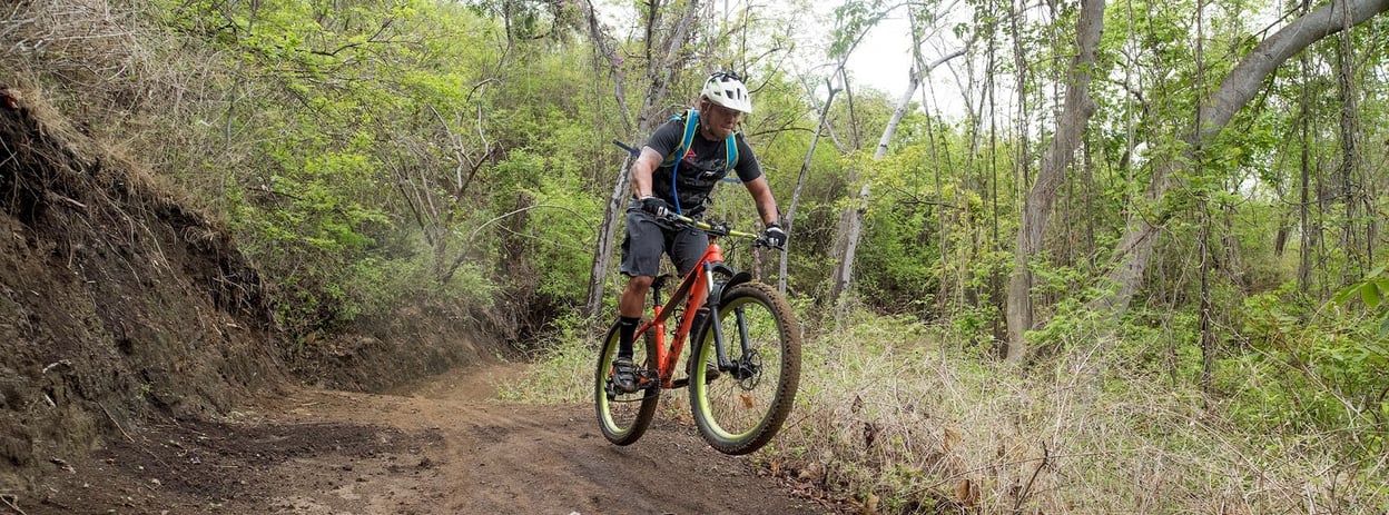
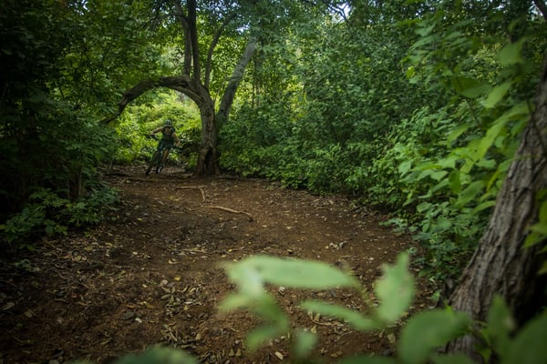
Las Catalinas has more than 42kms of multi-use single track trails in the 1000 acre tropical dry forest reserve that surrounds the beach town in Costa Rica. Ranging from the lowlands up through the hills to wind alongside the seaside cliffs and then down to the beaches and forest on the back of the mountain, these trails offer a versatile sporting environment for hiking, meditation, mountain biking, and events like the Intrepid Challenge, and Las Catalinas TRI.
In the reserve there are two main types of trails: multi-use trails for both hiking and biking, and trails dedicated exclusively to hiking. Each trail has been custom-built and are under constant maintenance by the local Agroforestales team in order to to maintain a safe and fun ride or run, and to help to rejuvenate the forest and prevent fires.
The Extended Reto | Climbs, Downhills, and the Perfect Flow
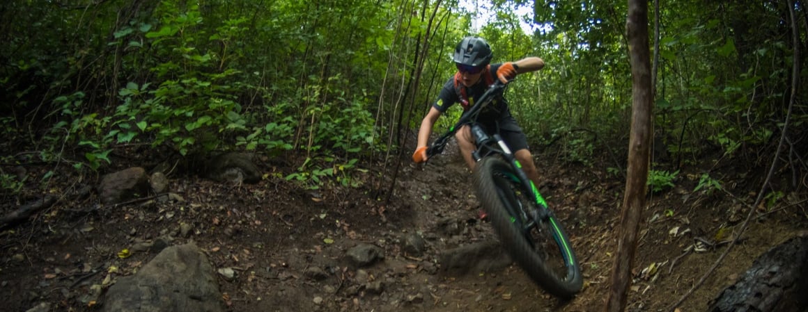
For the rider, the selection of routes aims to offer a diverse set of trails accessible to most beginners and enjoyed by expert mountain bikers, including sections with climbs, free flow portions along the hilltop, and thrilling downhills. Together, these trails are pivotal to the naturally active and physical lifestyle in Las Catalinas.
Riders can flow through any number of locally nicknamed trail segments and combinations. Segments include the Las Catalinas Reto route, a 22km long segment created for the year-long mountain bike competition, the circuit utilized in the Las Catalinas TRI, another of town’s major sports competitions, and others known colloquially as “El Reverso”, the “Extended Reto”, “Short Snack”, and the “Short Loop”.
Below, find the full list of mountain biking trails to be found in Las Catalinas.
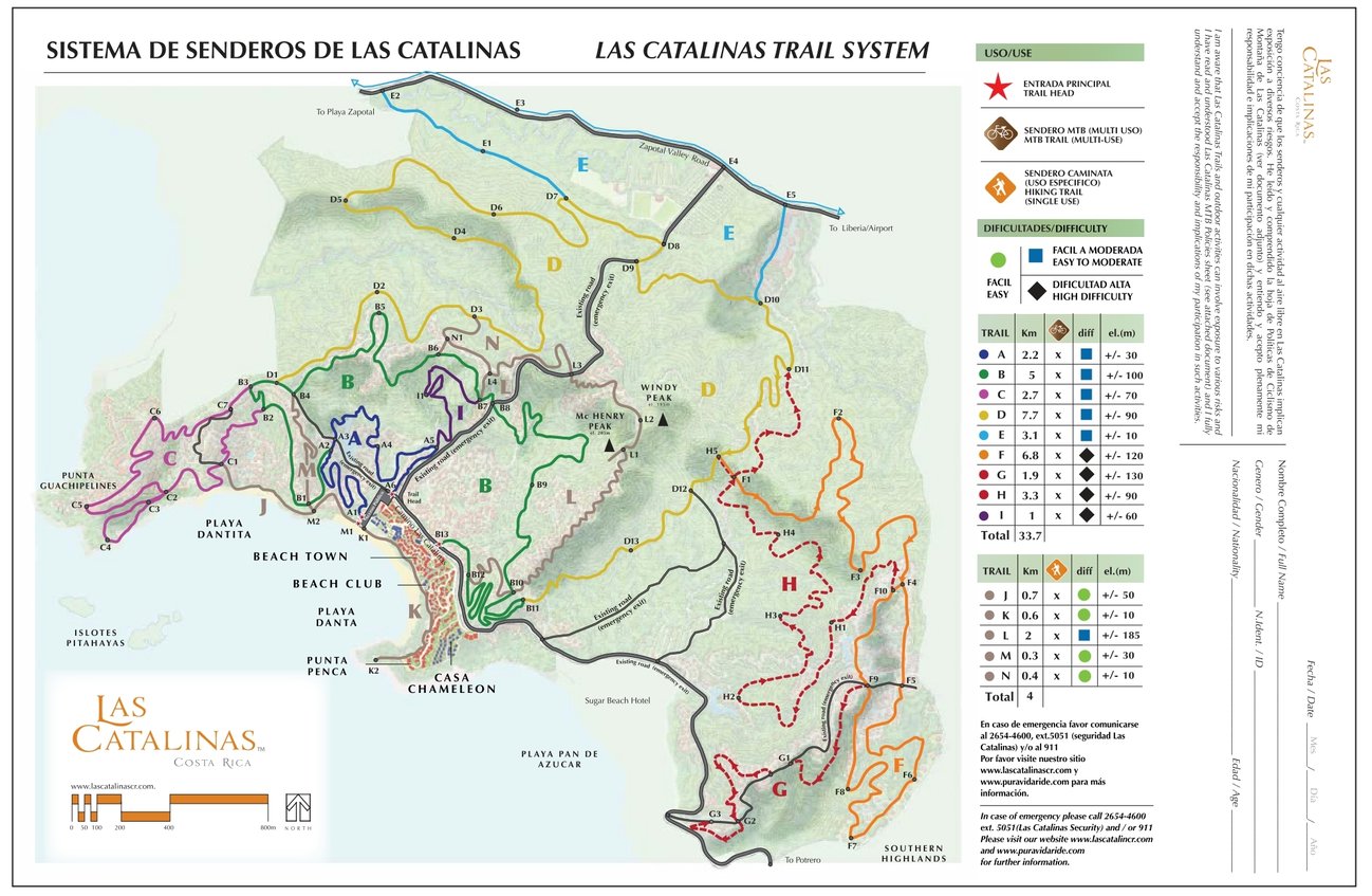
The most recent trail map.
![]()
Inicio
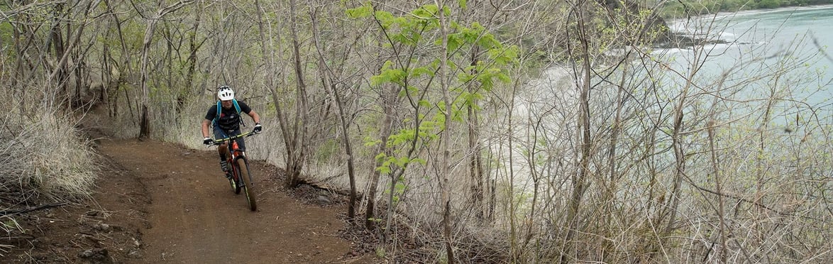
Marking the beginning of the official Las Catalinas Reto route, Inicio is a gentle climb from the trailhead through the lowlands of the tropical dry forest reserve, swooping through two seasonal streams before tacking up the hillside to converge with Principal. Inicio has a moderate elevation gain and is an easily accessible route for any rider entering the trails.
Inicio is an easy start to riding the trails
Principal
One of the two main entrances to the trail, Principal is one of the central climbs on the trails at Las Catalinas, winding through a seasonal stream, up out of the lowland forest along the hillside, out towards the cliffs of Punta Guachipelines, and the finally up a crosscut to the platform at the top of La Cresta. A slow and steady climb with a significant elevation gain, Principal strikes a smooth entrance to the Las Catalinas trails, covering a wide variety of terrain and surroundings en route to the tops of the ridges around town and one of the central jumping-off points for the Las Catalinas trails.
Principal is a gentle climb up the hillside, and connects to many of the trails on the mountain
Punta Guachipelines
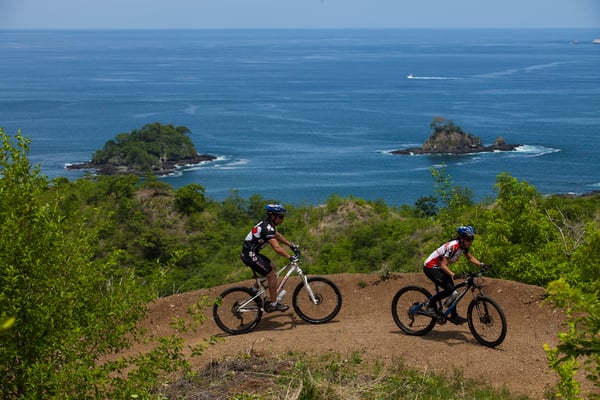
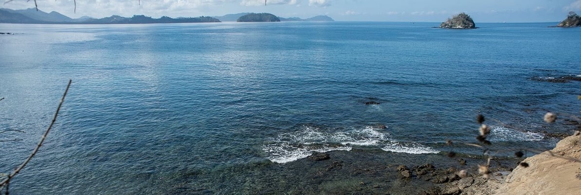
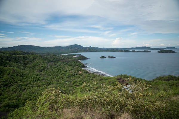
From the middle of Principal, Punta Guachipelines offers a circuit through the coastal cliffs at the tip of the eponymous Punta Guachipelines, characterized by steeper climbs and descents as well as some tighter switchbacks that offer a technical challenge for moderately experienced riders. The reward for tackling Punta Guachipelines is some of the most spectacular vistas of Town, Bahía de Potrero, and the Pacific, as well as the knowledge that one of the three main climbs of the Reto Route (one of four in the extended Reto) is complete.
Punta Guachipelines is one of the more challenging tracks in the reserve at Las Catalinas, but is still accessible to many different riders
Vuelta
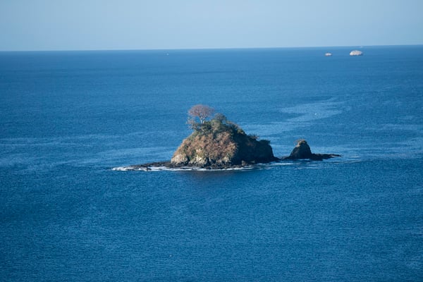
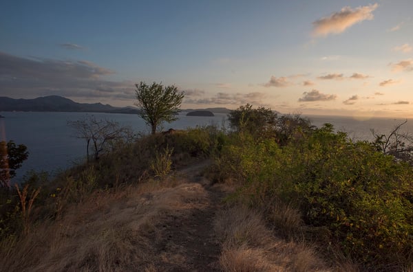
Vuelta is a short loop extending from the lowest-elevation portion of Punta Guachipelines down to a cliffside mirador looking straight out to the Pacific and the Catalinas Islands. Starting off as an out-and-back before branching into higher and lower portions, Vuelta is a moderately-challenging ride that offers a quick downhill portion to the mirador, followed by a rapid climb back up to Punta Guachipelines.
The vista at Vuelta looks out to the Islotes Pitahayas and the ocean
Las Cruces
The hilltop at the peak of La Cresta is the convergence of five different trails: Principal and Punta Guachipelines, which both feed into the hilltop, the hiking-only trail La Cresta, and two biking trails: Secreto and Las Cruces. Las Cruces begins the non-stop, high-intensity close of what many call “the short loop”, with a minimal elevation change, pulse pounding flow ride across the hilltop peaks down to the La Cuesta downhill and the trail exit, or can be a thrilling cross-mountain trek towards Zapotal.
Las Cruces cuts across the ridgetop, providing views across Town, the reserve, and the ocean
![]()
Secreto
Also departing from the La Cresta hilltop, Secreto is the continuation of the Reto route, a streak of swooping rollercoaster rides looping down into the nature reserve in the heart of the Zapotal Valley. Secreto has long slow downhills and corresponding climbs: one at the beginning, one in the middle, and one at the end, interspersed with the mountain’s largest berms and gently banked curves. As a whole Secreto is a thrilling ride with low to moderate difficulty that presents both the continuation of the Reto route as well as a second alternative of “the short loop” via the Union cutthough, a hiking-only trail that connects Secreto to La Cuesta and the trail exit.
Secreto's gentle berms and long, swooping curves make it a gentle but thrilling ride, where newer riders can easily cruise, and more experienced riders can open up
Arboretum
Down in the heart of the Zapotal Valley, Arboretum trends away from the more flow-centric trails towards a style reminiscent of gravel riding, with long, gentle forested trail and minimum elevation gain. Functioning as a connector between the end of Secreto, the Zapotal Valley Road, and the Donkey Trail, Arboretum offers a moderate 1.5km track either to cool down between high-elevation changes or pick up speed during races like the Las Catalinas TRI.
Arboretum is one of the closest trails to a gravel track on the mountain, like its neighbor Atajo
Atajo
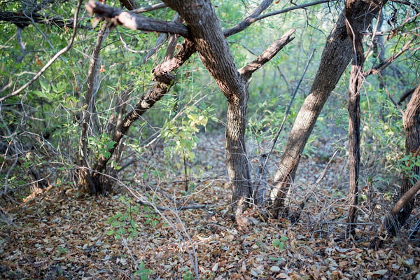
Much like its neighbor Arboretum, Atajo is 0.5km, low elevation change trail reminiscent of gravel riding that connects the Donkey Trail to Zapotal, and also marks the beginning of the Quemador segment of the Reto. Atajo also winds through one of the densest portions of forest in the reserve, making this part of the trail a frequent spot for sighting and sounds of wildlife.
Atajo goes through the most densely forested portion of the reserve
Zapotal
 Beginning on the Zapotal Valley road, Zapotal is a 4km trail that begins with a long and steady climb out of the Zapotal valley past the Highlands Connector to the upper third of McHenry Peak, before wrapping across the front of the bowl overlooking Beach Town. Encompassing the majority of the Quemador segment as well as the first half of the Cerrador segment of the Reto, Zapotal is one of the mountain’s most versatile trails.
Zapotal starts in the dense forest of the lowe Zapotal valley, has frequent ups and downs across the rugged topography, crosses several ridgelines, and finally begins a climb along the more sparsely forested base of McHenry peak before reaching the Highlands Connector to the Southern Highlands Trails. Further on up McHenry peak, Zapotal crosses the McHenry hiking trail before a rollercoaster ride along the bowl’s edge, finally crossing the road to intersect with La Cuesta, Las Cruces, and Union. (Zapotal is one of the longest routes on the mountain, and covers a wide range of terrain and landscapes).
The Highlands Connector
Branching off of Zapotal, this climb bridges the distance to the Southern Highlands trails, at the highest point of the nature reserve at Las Catalinas. There’s no getting around the steady-to-heavy climb on this trail, but the Highlands Connector presents untouched vistas of the Zapotal valley, offering a feeling of immersion in the wild not quite captured by any other trail.
The Highlands Connector provides a vista over the untouched nature of the reserve

The Highlands Loop
 The Highlands Loop is a circular flow loop designed for maintained momentum across the rolling forested hills
The first true loop in town (compared to Vuelta, which has overlapping sections as more of an out-and-back), the Highlands Loop has a net elevation change of zero, allowing for the skilled rider to carry momentum through nearly the entire trail on a series of swooping curves that wind through the forest, briefly out along the border of Pacific Heights, and back down into the woods, for a blend of urban and tropical forest backdrops.
The loop has a similar bikeable flow in both directions, resulting in one of the most satisfying trails in town to repeat or run back in reverse.
The Highlands Loop is the first designed-loop on the mountain, with net zero elevation gain and focused flow riding.
The Highlands Downhill
 The Highlands Downhill dips in and out of the forest, out into panoramic views of Bahía de Potrero and the surrounding towns, and then back into the heart of the dry forests.
Directly out past the Highlands Loop is the Highlands Downhill, the first specifically designed downhill in Las Catalinas. Starting at the beginning of the Highlands Loop and winding down the edge of the hillside to the point overlook beyond Sugar Beach, the Highlands Downhill is a ten minute or more sustained downhill ride complete with a number of curved berms, switchbacks, and swooping flow portions.
The Highlands Downhill is traditionally considered a light green downhill in line with the all-play accessibility of all trails in Las Catalinas. However, compared to the trails at Las Catalinas, it presents a more technical downhill segment than the rise-and-flow nature of the majority of the trails and a welcome reward at the end of a long ride. (The Highlands Downhill provides views over the Bahía de Potrero on a 10 minute thrilling downhill).
![]()
La Cuesta
Whether riding the Reto or any version of “the short loop”, La Cuesta presents a thrilling downhill portion at the end, a 1 km ride swooping down from the ridgeline through the forests, across two seasonal streams, and finally down through the beginning of Principal and out to the trailhead. On most mountains, La Cuesta would be considered a light green-level downhill, and offers an exciting yet accessible ride to cap off a trail ride for mountain bikers of all levels, with the added benefit of returning riders straight to the heart of town.
Cuesta is an exciting reward at the end of most loops on the mountain
Designated Hiking Trails
The five trails for hiking exclusively are called Union, Cresta, Danta, Dantita, and McHenry. These trails traverse the waterfront up to some of the highest points in Las Catalinas with numerous lookout points and the chance to encounter birds and other wildlife.
Union
 The shortest trail in Las Catalinas (100m), Union is a hundred-meter stretch that links several trails at the top of the mountain. Beginning at the midway point of Secreto, Union climbs directly up the hill to meet with Las Cruces, McHenry, and La Cuesta, and provides a short exit after the initial stretch before the long descent into the Zapotal valley.
Traveling quietly along this trail offers the chance to encounter birds and animals, as the forests on either side of the trail are full of life.
Union is a shortcut in the heart of the mountain, which is used frequently by both hikers and bikers
La Cresta
La Cresta extends for 0.4kms and begins just up the hill north of Beach Town, on the overlook between Playa Danta and Dantita. From there, this trail climbs through the forest, alternating between open views of the ocean and walking through deeper forest filled with life, before arriving at the overlook at the start of Secreto.
From this vista between Punta Guachipelines and Las Cruces, there are panoramic ocean views South towards town and Potrero Bay, west to the Catalinas Islands, and north to Playa Carmel. The views and the platform sitting at the top make this hilltop vista are well suited to meditation, a break to enjoy the breeze, or a hilltop picnic after a hike.
The top of La Cresta has some of the most far-reaching views in Las Catalinas
Dantita
Dantita is a 0.9km hiking trail that links Playa Danta and Playa Dantita, which crosses the hill between the two beaches and offers alternating views of tropical dry forest and the ocean with a constant ocean breeze. The vista midway through the trail has a view towards the Islotes Pitahayas, which are often surrounded by frigatebirds in flight.
Dantita is a short trail connecting the two beaches around Las Catalinas
![]()
Danta
 The Danta trail of 0.6km starts by Plaza Danta, and traces the beach all of the way down past town to the small mirador at the end of Punta Penca. This trail has a diverse set of surroundings, starting off just a few feet away from the walkable street of Paseo del Mar, passing the Beach Club and the Monkey Corridor, curving past Calle Cartagena, and then rising up through the forest at the base of Paseo Punta Penca before arriving at the point, all in constant view of the ocean.
The small park at the end of Punta Penca has wooden benches, as well as views in three directions -- south towards Potrero Bay, west out towards the ocean, and north towards Punta Guachipelines, the islotes Pitahayas, and the bay. (Danta rounds the cove, passing all along the Las Catalinas beachfront)
McHenry
 The McHenry trail is the longest in Las Catalinas (3.1km) and begins just across Camino Las Catalinas from Plaza Central, where it climbs to the top of McHenry Peak and then loops across the mountaintops towards Windy Peak, crosses the Donkey Trail, and then converges back with Union, Las Cruces, and La Cuesta.
McHenry first hugs the front of McHenry Peak, with a constant view of town and the ocean as it winds up along the hillside. After converging with Zapotal, McHenry peak begins to break the treeline, before reaching the McHenry Peak vista at the top, which has a full panoramic view over town, the coast, and the surrounding region of Guanacaste. The next phase of the trail is along the tops of the hills, with prominent views and four more lookout points on Windy Peak.
The hike to McHenry Peak and back is a bit more than 2km round trip, with the full trail offering a longer hiking loop that traces the entire ridge surrounding Las Catalinas. (McHenry Peak has a full 360 degree vista of the area)
Visit Them Yourself
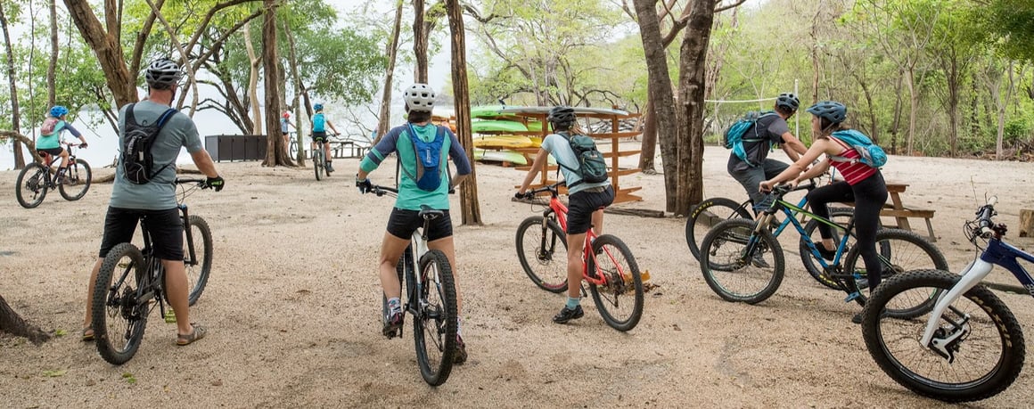
The best way to get a sense of these trails is to get out and ride or walk them. All trail heads in Las Catalinas are within a short walk of town’s homes and the Santarena Hotel, which makes it easy to depart straight from home with no need for transit time or packing and unpacking gear.
Equally important, these trails are the best way to step out and explore the dry tropical forest reserve around town. With 42km of mountain biking trails and 5 hiking trails that range from coastal cliffs down into the heart of the forest, nature is just a step away no matter where you are in Las Catalinas.